The wild coast of Point Reyes juts out into the Pacific Ocean northwest of San Francisco. Often fogbound, this graveyard of ships in the early years of Pacific navigation divides into two arms. The better-known of these forks heads out to the western-most point in the continental United States and the Point Reyes light.
If you go the other way on Point Reyes, you travel along a massive peninsula towards Tomales Point. The peninsula divides the sheltered waters of Tomales Bay from the rugged open Pacific (so Point Reyes is a small isthmus away from being an island rather than a peninsula).
The road along the back of the Tomales Point peninsula crosses into the Tule Elk preserve and then ends at McClure Beach and an old farm (not now operating) 4.7 miles shy of Tomales Point itself. The trail that proceeds from the parking lot at the farm crosses what is one of the largest roadless areas any where near San Francisco. Even on the park service map of Point Reyes, this is an area that is blank white space and without named landmarks.
The week before, Mark and I had set out down the Tomales Point Trail, but we turned around out sunset only half way down the trail. This time we tried to leave early enough to get all the way to Tomales Point by sunset. We brought warm clothing and snacks so that walking part way back at night would by OK.
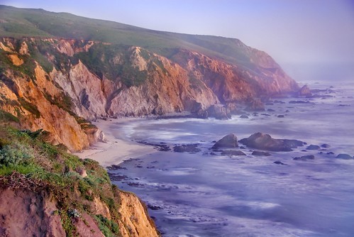
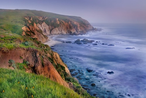
I took this photo on the return leg of our hike about 45 minutes after sunset from a cliff overlooking the Pacific shore. The view is northwest, towards the other fork of Point Reyes and the lighthouse.
There was barely enough light for me to see. This is an eight second exposure, with the lens wide open. The breakers rolling in from the wide Pacific have been turned mellow by the length of the time exposure. In digital photography’s day for night effect, the cliffs actually look much brighter than they did in “real life.”
We got back to the trailhead under a brilliant star-filled sky and a crescent moon. It took an hour to drive back to Route 101 and the Marin version of the heart of civilization. In Mill Valley, after 11PM, it’s hard to find an open restaurant. The only place we found to grab some dinner was an all-night Denny’s off Route 101. So this was truly a trip that touched the sublime and the trivial (and, yes, even the Denny’s dinner tasted good after the hike!).
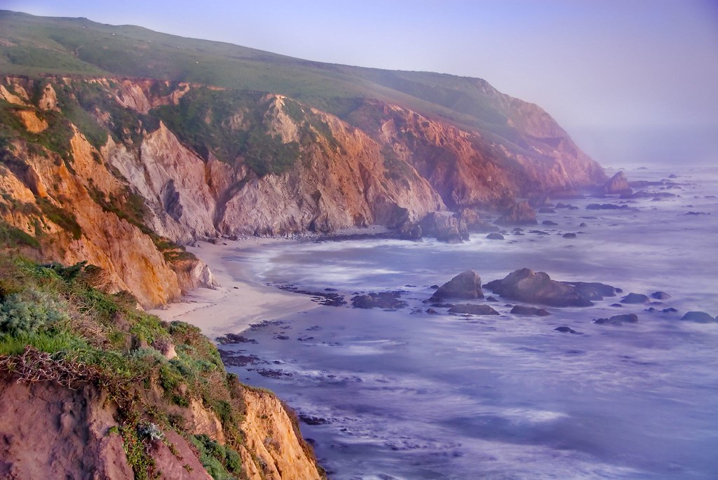
Here’s another version of this image, from a wider angle. It’s an even longer exposure (thirty seconds):
View this image larger.
Related links: Point Reyes category on Photoblog 2.0, my Night set on Flickr.
Pingback: Photoblog 2.0: » Photoblog 2.0 Archive: » Kid Break
Pingback: Photoblog 2.0: » Photoblog 2.0 Archive: » Patterns of Design
Pingback: Photoblog 2.0: » Photoblog 2.0 Archive: » On Night Photography
Pingback: Photoblog 2.0: » Photoblog 2.0 Archive: » Digital Darkness
Pingback: Photoblog 2.0: » Photoblog 2.0 Archive: » Lee Shore
Pingback: Photoblog 2.0: » Photoblog 2.0 Archive: » McClure Beach
Pingback: Photoblog 2.0: » Photoblog 2.0 Archive: » Between Earth and Sky
Pingback: North Fork | Photoblog 2.0