After reluctantly leaving Hot Creek, I headed down Route 395 into Owens Valley. (View road map of my route here.)
Between the Sierra crest on the west rising to heights above 14,000 feet, and the White Mountains to the east — with summits above 12,000 feet — Owens Valley is the deepest valley in the United States. It’s elevation varies, but is typically around 4,000 feet, so you are looking at a valley that is 8,000 feet deep. Deeper, in other words, than the Grand Canyon.
Here’s a photo looking across the valley towards the Sierra crest:
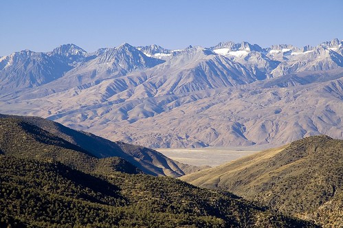
I think that Owens Valley is one of the surpassingly beautiful places on this earth. It is still fairly undeveloped, although beginning to get a little more crowded.
Early last century, the city of Los Angeles engineered a notorious heist of the water flowing through the valley. In some ways, this may have helped preserved the remote, undeveloped, and beautiful feeling of Owens Valley. (Although this was surely not the motivation of the Angelenos, who merely wanted to wash their cars, water their lawns, and fill their swimming pools.)
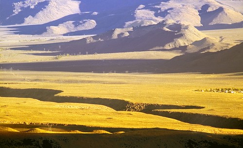
The photo at the top of this story shows the inner Owens River gorge, which has become a climbing mecca. The climbing spot is to the left and behind this picture.
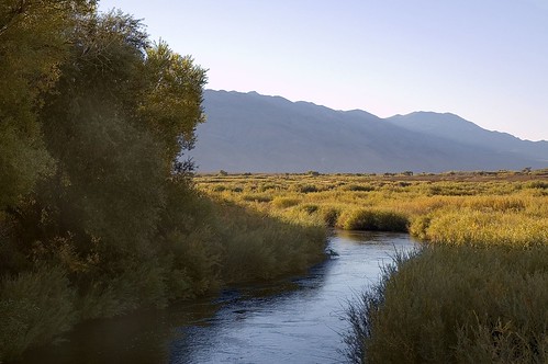
Further down Owens Valley, the river becomes a gentle creek, as you can see in this picture I took of an Owens River swimming hole in the early morning:
Pingback: Photoblog 2.0: » Photoblog 2.0 Archive: » Seeking Methuselah
Pingback: Photoblog 2.0: » Photoblog 2.0 Archive: » Lonely Road
Pingback: Photoblog 2.0: » Photoblog 2.0 Archive: » Mount Whitney Sunrise
Pingback: Photoblog 2.0: » Photoblog 2.0 Archive: » Road Trip Wrap-Up
Pingback: Photoblog 2.0: » Photoblog 2.0 Archive: » Homeward Bound
Pingback: Photoblog 2.0: » Photoblog 2.0 Archive: » Crossroads of the Cowboy Universe
Pingback: Photoblog 2.0: » Photoblog 2.0 Archive: » Tioga Pass Road at Night
Pingback: Touching the Rainbow | Photoblog 2.0
Ed Carlson
7 Jun 2014Actually the White Mtn peak directly NE of Bishop is over 14,000 ft, so the valley floor is technically 10,000 ft below.