
Mark and I left the car where the Miwok Trail crosses Route 1. We climbed the Miwok Trail, glancing at wide vistas of the suburban sprawl of Marin County. From the top, there was a wide and serene view in all directions, with the top of the Golden Gate Bridge popping up through a notch in the hills on the south side of Tennessee Valley.
We wandered down Coyote Ridge, and followed the Coastal Fire Road to its southern junction with the Pacific Coastal Trail. From the junction, we turned north on the Coastal Trail, and followed it up, down, and around for a series of spectacular views of ocean and the hills of the Marin Headlands.
Taking our time, we stopped to photograph turkey vultures, lupine, and textures in the grass. We examined what may have been mountain lion scat. We took a side scramble down to the wild beach at Pirate’s Cove.
By the time we reached the cliffs on the south side of Muir Beach, the sun was quickly setting and the world was getting dark.
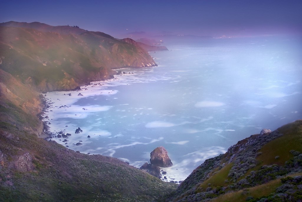
Looking back along the coast at Pirate’s Cove and beyond, I exposed this image with my camera on a tripod, holding the shutter open for thirty seconds. There was a light fog coming in off the sea. The long exposure picked up colors in the headland cliffs, mist, and fog not visible to our naked eyes.
If you look closely at the photo, you can see the light from the Point Bonita lighthouse, as well as some of the lights of South San Francisco.
A little footsore, we trudged down to the Pelican Inn in the dark. At 9PM, the restaurant was just closing. Amy picked us up, we had stew and sandwiches at Mark and Amy’s house, then I drove to my home across the Bay.
Related links: Park service trail map of the Marin Headlands.
Pingback: Photoblog 2.0: » Photoblog 2.0 Archive: » Peeking Bridge
Pingback: Photoblog 2.0: » Photoblog 2.0 Archive: » Sausalito at Twilight
Pingback: Photoblog 2.0: » Photoblog 2.0 Archive: » San Francisco from Muir Beach Overlook
Pingback: Photoblog 2.0: » Photoblog 2.0 Archive: » Dusk at Pirate’s Cove
Pingback: I Am a Talking Head for Nikon